Save the Children analysis puts Torfaen fourth in the world for wildfire carbon emission intensity in July
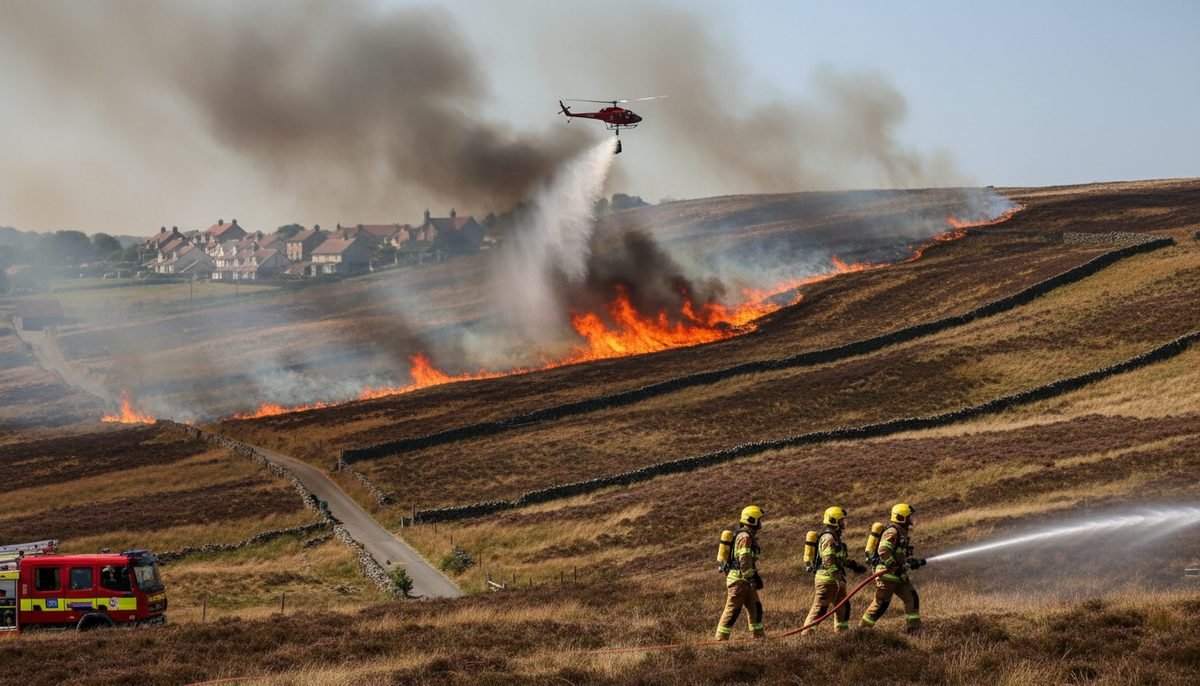
A wildfire above Blaenavon that has burned since 19 July has left a Welsh county borough ranked alongside sites in Algeria, Spain and Angola for emission intensity.
UK News & Politics Editor ·
Why it's trending
Save the Children published analysis of Copernicus Wildfire Emissions Watch data on 19 August 2026 ranking Torfaen fourth in the world for wildfire carbon emission intensity during July, driven by the Blaenavon fire that started on 19 July.
Torfaen recorded the fourth highest intensity of wildfire carbon emissions per square kilometre of anywhere in the world during July, according to analysis of Copernicus satellite data published by Save the Children.
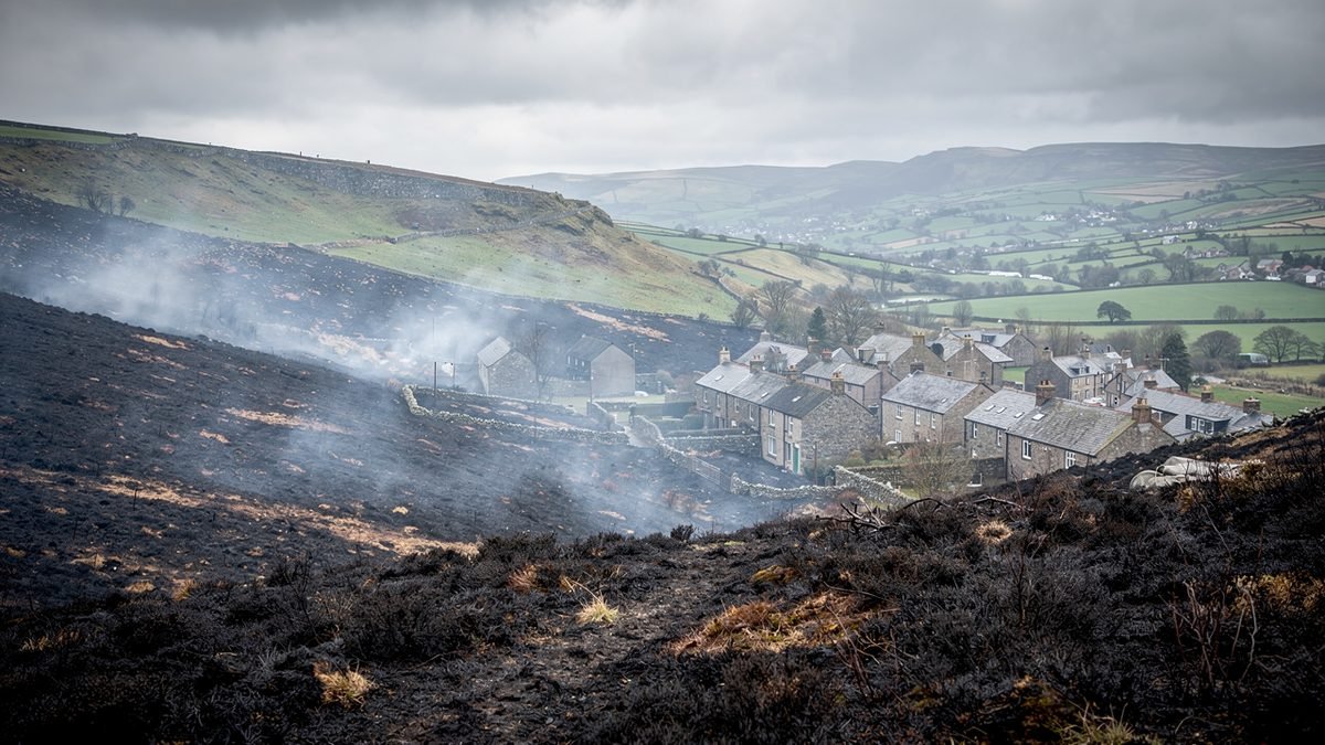
The county borough was ranked behind only Annaba in Algeria, Avila in Spain and Malanje in Angola. The figure is driven overwhelmingly by a single fire on the hillside above Blaenavon, which started on 19 July and was still burning a month later. The fire service has described it as one of the largest and most challenging in South Wales in recent years.
Some 20,952 children and young people under 19 live in Torfaen. Melanie Simmonds, head of Save the Children Wales, said children were breathing in smoke from wildfires, coping with extreme heat and losing freedom to play outdoors.
At a glance
- Torfaen ranked fourth in the world for wildfire carbon emission intensity per square kilometre in July 2026.
- Only Annaba in Algeria, Avila in Spain and Malanje in Angola ranked higher.
- The Blaenavon fire began on 19 July and was still burning a month later.
- 20,952 children and young people under 19 live in Torfaen.
- Globally, 15 million children were in areas with extremely unusual emission levels between 4 July and 4 August.
- 84% of children in Wales experienced extreme heatwaves in the first half of 2026.
How a small county tops a global table
The ranking measures intensity rather than volume: emissions divided by land area. Torfaen is one of the smallest county boroughs in Wales, so a fire burning continuously for a month across a substantial part of its uplands produces a figure that no measure of total tonnage would ever flag.
That is not a statistical quirk to be waved away. Intensity is the metric that matters for the people underneath the smoke, because it approximates how concentrated the exposure is over the ground where they actually live. A large fire in a sparsely populated region disperses; a comparable fire ringed by valley towns does not.
Peat is what makes it persist
Upland fires of this kind rarely burn out on their own timetable. Where fire reaches organic soils it can travel below the surface, smouldering through peat and dry root layers for weeks and re-emerging some distance from where crews last saw flame. That is the pattern that turns a fire into a month-long event.
It also explains the emissions. Surface vegetation burns quickly and releases a limited amount of stored carbon. Peat holds far more, accumulated over centuries, and once it ignites it releases that carbon steadily for as long as the material stays dry enough to burn.
The exposure question
Blaenavon sits directly below the affected ground, and the smell of burning has been reported around 30 miles away in Cardiff. Wildfire smoke carries fine particulate matter, and children are more exposed than adults for reasons of physiology rather than behaviour: faster breathing rates, smaller airways, and lungs that are still developing.
Save the Children's wider analysis found that 15 million children worldwide were in areas with extremely unusual emission levels between 4 July and 4 August, with a further 11 million in areas above normal. The charity also reported that 84% of children in Wales experienced extreme heatwaves during the first half of this year.
A wet-then-dry pattern
The conditions that produced this fire are the ones fire services have been warning about for several summers. Vegetation grows through a wet spring, then dries out during a hot, rainless early summer, leaving a heavy fuel load in exactly the state that carries fire across upland ground.
Torfaen is not an outlier in that respect. Hot, dry weather drove hundreds of fires near densely populated towns and cities worldwide between early July and early August, and the analysis places the Welsh valleys inside that pattern rather than outside it.
What happens next
The immediate question is whether the fire is fully extinguished before autumn rainfall arrives, and whether the burnt ground stabilises. Bare upland soil is vulnerable to erosion and run-off once heavy rain sets in, which shifts the risk from smoke to water in the months that follow.
The longer question is one of land management: how much of the affected ground was in a condition to burn, and whether restoring peat and reducing fuel loads is treated as fire prevention rather than as a conservation aspiration. On present evidence, Torfaen has had an expensive demonstration of the difference.
Sources & verification
- Save the Children UK — primary reporting and official updates
- Reporting reviewed on 22 August 2026; figures as published at that time
Filed under UK News · Written by Eleanor Whitfield
You may also like to read